Tajikistan's Pamir Highway
Exploring the Wakhan Corridor: where Tajikistan, Afghanistan, Pakistan & China meet
Nick had one last “Stan” to visit before completing a clean sweep of Central Asian nations. His midnight Somon Air flight from Frankfurt to Dushanbe was rewarded with spectacular views of the Fergana Valley and Registan Square of Samarkand, Uzbekistan on its dawn descent. After landing at the deserted airport he secured the sensitive material plane side, haggled with security over his tarmac status and then with a gaggle of immigration officers concerned about his visa before finally being allowed into Tajikistan.
Tired after a sleepless flight, but not wanting to doze during the day, he decided to push the envelope and set off on an exploration of the capital. Strolling from the hotel towards downtown, he first came across a fairground full of sketchy rides that would be condemned elsewhere. Yet, even at an early hour, colorfully clothed families crowded the amusement park and swimming area along the lake shore on its backside, thoroughly enjoying themselves.
Across a bridge fording the mighty Varzob River gushing from a dark canyon in the snowy Hissar range to the north rose the Palace of the Nation, the official residence of only the second president the country has known since the 1991 dissolution of the Soviet Union: Emomali Rahmon. The first President, Rahmon Nabiyev (1991-92), elected after the break-up of the Soviet Union, was forced to resign at gunpoint after being ambushed by opposition forces outside the airport terminal ahead of the five-year Tajik Civil War (1992-97).
Emomali Rahmon came to power during the nascent stages of a civil war that killed upwards of 20,000 people and displaced 20% of the population, but he eventually sealed a peace deal. It was an ethno-religious conflict between the old Soviet guard and a burgeoning Muslim movement; the former, protected by Russian Border Guards, distributed weapons to its allies across the country while the latter received arms from the Afghan Mujahideen.
Surrounding the palace is Rudaki Park with the second largest flag in the world flying overhead. Continuing downtown, Ozodi Square with its impressive 25 meter Ismoil Somoni (849-907) statue celebrating the Emir of the Sassanid Empire as the founder the Tajik state, is intriguing.
Downtown Dushanbe is charming, with Rudaki Street lined with exquisite neoclassical Russian architecture housing the standard opera, museum, library and university buildings found in all Commonwealth of Independent States’ capitals. There is drab Soviet architecture interspersed between these gems, but overall it is a pleasant stroll along tree-lined streets all the way to a utilitarian rail station.
The following day, Nick and two colleagues took leave for an overland trip along the banks of the mighty Panj River (forming the Afghan border) to the Wakhan Corridor where Tajikistan, Afghanistan, Pakistan and China meet. Their first stop was the lovely town of Khorugh on the way to Iskhoshim at the entrance of the corridor, but getting there was an ordeal in itself due to the precarious state of the Pamir Highway. Driving east from Dushanbe the rough two lane passes through uninspiring terrain until reaching the Surkhob River, where a precarious route begins high on a cliff face above its surging torrent. This deteriorating stretch of road with jaw dropping scenery is a precursor for what lies ahead, the junction with the M-41 Pamir Highway to Qal’aikhum.
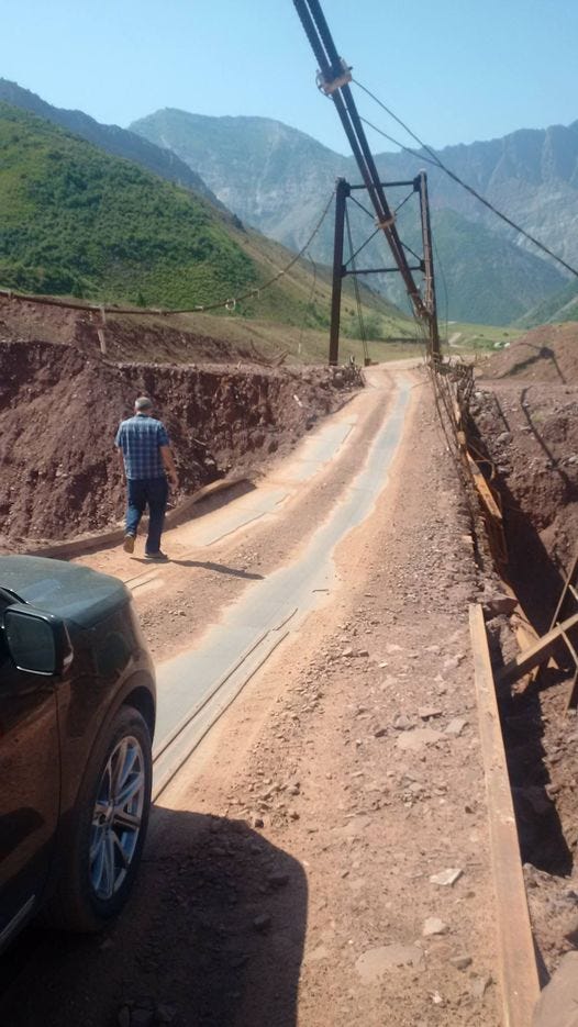
Crossing the swaying Surkhob Bridge into the Pamir region of the country is the beginning of an epic drive. Across the suspension bridge is a government check point ensuring travelers have the appropriate visa to enter the Gorno-Badakhshan Autonomous Region. The following track across sketchy bridges and landslide covered roads is something to behold. The Chinese are currently helping the Tajiks improve their infrastructure. If any stretch of road needs help it is the M-41’s slow climb over the rolling mountains between the Surkhob River and Qal’aikhum.
They took this route because the “better” road along the Panj River accessed south of Dushanbe was washed out, but what an inspiring landscape it traversed.
After passing through the rocky gorge above and over a landslide recently cleared by a bulldozer, they began climbing to a pass via multiple switchbacks through meadows covered in lupine. At the top of the pass the road narrows to the width of a car, with a thousand foot drop to the west. It would be difficult to reverse for oncoming traffic, to say the least.
After navigating the pass the road drops precipitously through a rocky canyon to Qal’aikhum, situated along the Obikhumbou river.
After the remote and hazardous terrain they’d driven through, arriving in Qal’aikhum was an oasis: there were shops, a gas station and hotel with Afghanistan across the massive Panj River flowing fast.
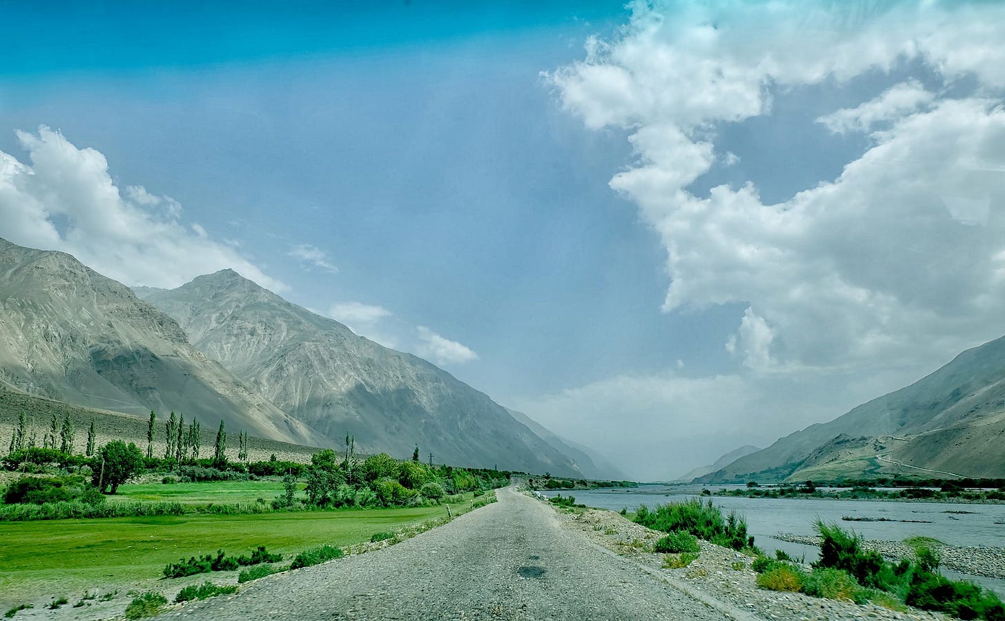
Heading south from Qal’aikhum they recognized this as the main Pamir route, because even though a rough dirt track across sand banks and under towering cliffs, trucks from Kashgar, China rolled past.
The Pamir Highway is so narrow that they had to constantly pull over to allow convoys to pass. This is why the Chinese Government (through the China Road & Bridge Corporation: CRBC) has already invested $2 billion to help the Tajiks improve their infrastructure as part of the Belt & Road Initiative (BRI): it will increase trade between not only these two countries, but with the rest of Central Asia.
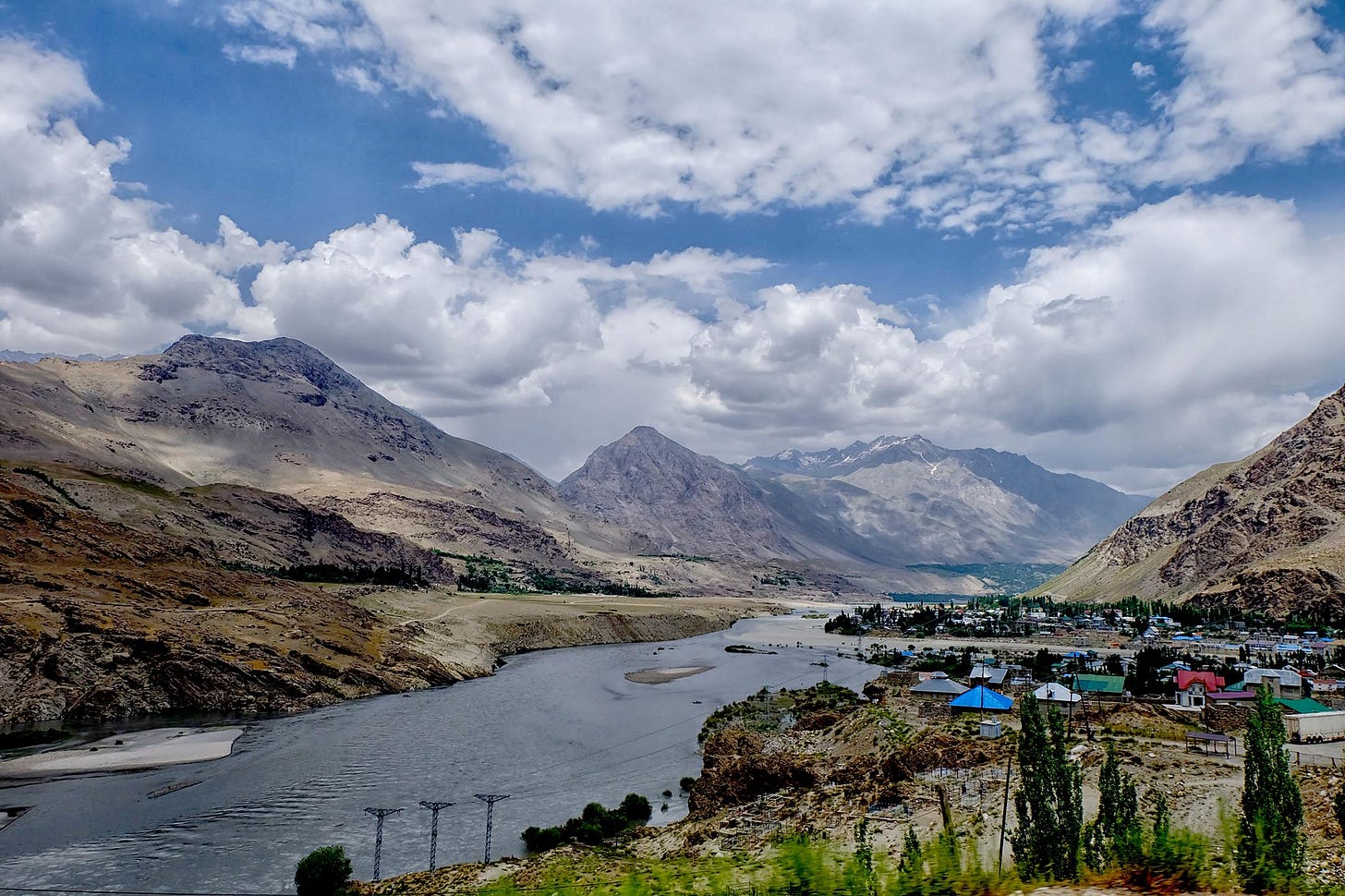
For the entirety of the 340 km drive from Qal’aikhum to Iskhoshim, Afghanistan, with its charming villages separated by steep gorges, remains 100 meters or so across the river. They occasionally passed Tajik military patrols along the Pamir Highway, but such close proximity to one of the world’s ongoing wars was unsettling. On the surface, the scene across the river was bucolic: shalwar kameez clothed Afghanis were busy tending their fields and farm animals amidst tidy adobe houses. The Taliban not only control the provincial capital of Badakhshan Province (Feyzabad) across the river, but according to a recent New York Times piece have multiple prisons there where torture is commonplace. In truth, the mighty Panj is flowing so fast it would be dangerous to make a crossing, but surely a black market exists despite the lack of boats.
Even though he’d visited Kabul, it was hard for Nick to fathom the stark reality that existed across the Panj torrent, not to mention the US occupation of the country for almost 20 years: the longest war in American history. After a brutal day of driving, culminating in a final stretch of narrow gorge along a jarring, washed-out road, they arrived in Khorugh ready for dinner, beer and bed.
Given the remoteness of the town, the hotel and cuisine were more than adequate and the Tajik people welcoming. The morning lit a bustling town, where women dressed in flowery shalwar kameez, while the men looked like latent Soviets, in dour dress pants and white button-down shirts.
They continued south along the banks of the Panj to the Wakhan Corridor. Known as the Panhandle of Afghanistan, it was formed in an 1873 agreement between the British and Russians as a buffer between their competing empires during the heyday of The Great Game. The narrow valley of the Panj begins to open to the south, and at the charming town of Iskhoshim the road swings sharply east to follow the Tajik border towards China. There is a bridge in Ishkhoshim and a border crossing is possible. After passing through Iskhoshim with its lovely tree-lined streets, they were awed by the monumental topography of the Wakhan Corridor, surrounded as it is by four countries. Even though only 200 km one way, it took a half-day of driving from Khorugh to the source of the Panj at the confluence of the Pamir and Wakhan Rivers. Marveling at the jagged, snow-capped Pakistani peaks across the Afghan valley to the south, Nick reminisced about an unforgettable trip to Chitral during a mission to Islamabad years earlier, a lovely town just 100 km from the Wakhan.
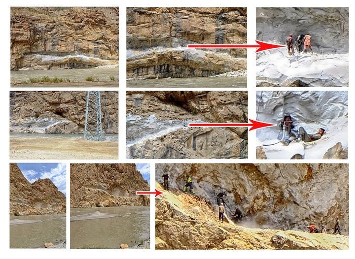
With at least a sketchy “highway” along the Panj River connecting various towns with Dushanbe and even Kashgar, the Tajiks are fortunate for the road building skills of the former USSR. Not so the Afghans on the opposite bank: they are trying to replicate the Pamir Highway across the river by jack-hammering a road out of cliff faces in order to link their isolated villages.
Such close proximity to a war zone unfortunately took its toll in July 2018 when five militants in a car ran over seven Western cyclists outside Norak, south of Dushanbe. Four cyclists, including two Americans, were killed after the Tajiks jumped from their vehicle and repeatedly stabbed the adventurers as they lay sprawled on the highway. A Swiss and a Dutch citizen were also killed and three other cyclists were injured, including one from France. Police pursued and killed four of the attackers and arrested one. ISIS later claimed responsibility, saying its soldiers struck “citizens of coalition crusader countries”.
Nick thought it strange there hadn’t been spillover from the ongoing war against the Taliban, ISIS and Al Qaeda next door, but this attack proved otherwise. Tajikistan is a glorious country and the Pamir mountains crowned by Ismoil Somoni Peak (7,495 m, 24,590’) should be a mecca for travelers from around the world. Before his flight back to Frankfurt, Nick explored Bala Hissar west of Dushanbe, a 16th century fortress on the Silk Road and former home of the Deputy Emir of Bukhara, yet another Tajik gem.
© 2021 James B. Angell All Rights Reserved


